Research Project Summary
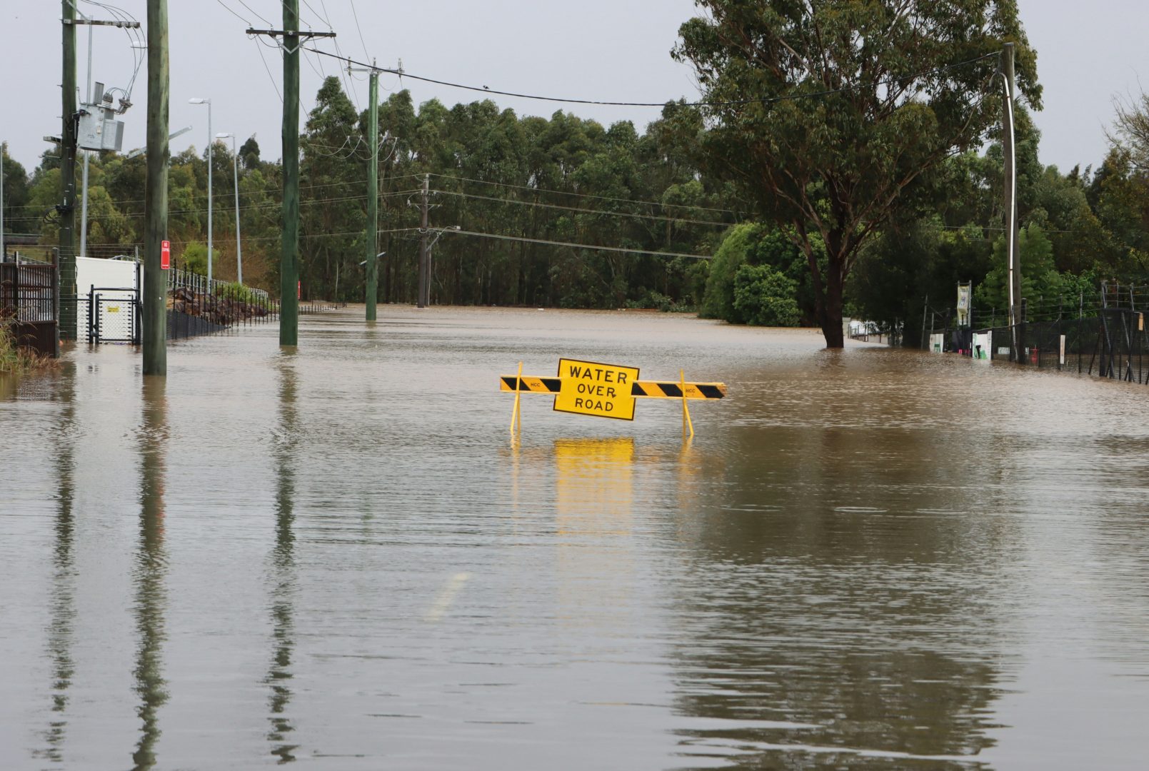
This project examines how climate-driven flooding and infrastructure disruption affect healthcare access in Cape May, Cumberland, and Salem Counties in southern New Jersey. These rural, coastal counties face historic economic challenges and chronic underinvestment in transportation and healthcare. Rising sea levels and stronger storms increase roadway flooding and community isolation, which can delay or prevent timely care, especially during emergencies.
The project centers on residents most likely to face barriers to care, including older adults, low-income households, people with disabilities, and people without reliable access to a car. It asks where high health needs and mobility constraints intersect, and which places face the greatest risk of being cut off from essential services during flood events.
The study links emergency department utilization with transportation vulnerability, flood exposure, and human mobility patterns. At the census tract level, we will estimate overall emergency department visit rates and rates for general and climate-sensitive conditions using New Jersey hospital discharge and emergency department data. Flood exposure will be characterized using Federal Emergency Management Agency (FEMA) flood zones and National Oceanic and Atmospheric Administration (NOAA) sea-level rise projections, then integrated with the regional road network to identify flood-prone routes and potential isolation. Human mobility data will help characterize travel patterns and how movement may shift during disruption in developing a place-based measure of access across three South Jersey counties.
A core part of this project is community partnership with healthcare providers and community-based organizations to ensure our project results translate into action. Key outputs will include public-facing maps and a regional briefing that identifies “climate–health access gaps”. Findings will inform targeted outreach, emergency transportation planning, and resilient infrastructure priorities, and advance the South Jersey Institute for Population Health goals for health equity and regional resilience.
Research Project Goals
This project examines how climate-driven flooding and infrastructure disruption affect healthcare access in Cape May, Cumberland, and Salem Counties in southern New Jersey. These rural, coastal counties face historic economic challenges and chronic underinvestment in transportation and healthcare. Rising sea levels and stronger storms increase roadway flooding and community isolation, which can delay or prevent timely care, especially during emergencies.
The project centers on residents most likely to face barriers to care, including older adults, low-income households, people with disabilities, and people without reliable access to a car. It asks where high health needs and mobility constraints intersect, and which places face the greatest risk of being cut off from essential services during flood events.
The study links emergency department utilization with transportation vulnerability, flood exposure, and human mobility patterns. At the census tract level, we will estimate overall emergency department visit rates and rates for general and climate-sensitive conditions using New Jersey hospital discharge and emergency department data. Flood exposure will be characterized using Federal Emergency Management Agency (FEMA) flood zones and National Oceanic and Atmospheric Administration (NOAA) sea-level rise projections, then integrated with the regional road network to identify flood-prone routes and potential isolation. Human mobility data will help characterize travel patterns and how movement may shift during disruption in developing a place-based measure of access across three South Jersey counties.
A core part of this project is community partnership with healthcare providers and community-based organizations to ensure our project results translate into action. Key outputs will include public-facing maps and a regional briefing that identifies “climate–health access gaps”. Findings will inform targeted outreach, emergency transportation planning, and resilient infrastructure priorities, and advance the South Jersey Institute for Population Health goals for health equity and regional resilience.
Research Project Objectives
1) Build an integrated, tract-level dataset that links emergency department use, social vulnerability, roadway connectivity, flood exposure, and human mobility indicators across Cape May, Cumberland, and Salem Counties.
2) Produce baseline profiles of healthcare access by summarizing typical travel patterns to hospitals, urgent care, and dialysis services, and documenting where access is already constrained.
3) Compare mobility patterns across risk contexts to understand how movement differs between higher- and lower-risk areas and to flag communities with limited adaptive travel options.
4) Develop a place-based typology of vulnerability that classifies census tracts by combinations of health need, flood exposure, transportation constraints, and mobility limitations to support prioritization.
5) Co-produce decision-ready deliverables with community and institutional partners, including public-facing maps and a concise regional briefing tailored to planning, emergency management, and health outreach use cases.